WM Instrument Adapter with laser plummet Corbin used to survey the Washington Monument. NOAA has been performing a geodetic survey of the peak of the Washington Monument this week as the scaffolding begins to be dismantled. The survey part of the on-going restoration of the Monument following the April 2011 earthquake.. Although the peak of the monument has been used as a visible survey point for over a century, it is extremely rare for the peak to be occupied by survey equipment. The last time the peak was occupied was in 1999 during a monument restoration project. NOAA has engineered an adapter to affix the GPS antenna on the peak of the monument for the project. The new survey combines both GPS placements as well as several new measurements not done in 1999. This survey will hopefully establish a definitive height for the peak of the monument and serve as a critical reference point for detecting changes overtime. The 2013 and 2012 surveys of the Monument grounds and height elevations will be compared with historic data for the purposes of detecting any ongoing changes or those caused by specific events such as the 2011 earthquake and are part of a larger on-going effort by NOAA and the National Park Service to establish on going benchmarks to help note changes and preserve the historic structures and area.
Featured Photo Galleries

Military parade celebrates Army’s 250th
Cheers and chants rang out Saturday from a crowd of thousands as soldiers manned modern and historic tanks and aircraft for the Army’s 250th anniversary celebration in the District.


Ovi scores goal 890, Caps lose to Sabres 8-5
Alexander Ovechkin scored goal number 890, but the Washington Capitals fell short, losing to the visiting Buffalo Sabres Sunday afternoon 8-5 at Capital One Arena in Washington D.C., March 30, 2025 (Photos for the Washington Times.)
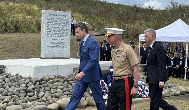
Hegseth joins veterans, generals to mark 80th anniversary of battle of Iwo Jima
A handful of retired Marines – all in the late 90s or over 100 — joined Defense Secretary Pete Hegseth and Japan’s Prime Minister Takeru Ishida on Saturday to mark the anniversary of one of the bloodiest battles of World War II in the Pacific that ended 80 years ago this week.