This Thursday, Nov. 8, 2018, satellite image provided by geology professor Jeff Chambers at the University of California, Berkeley, shows a short-wave infrared (red) image captured by Landsat 8 showing the full extent of the actively burning area of the Camp Fire about four hours after it started over the town of Paradise, Calif. The red patches are fires that leapfrogged in front of the primary burn front, which was growing at a rate of approximately 3 mph (5 kph). Multiple deaths have been reported and hundreds are unaccounted for in the nation's deadliest wildfire in a century. (Jeff Chambers/University of California, Berkeley via AP)
Featured Photo Galleries

Military parade celebrates Army’s 250th
Cheers and chants rang out Saturday from a crowd of thousands as soldiers manned modern and historic tanks and aircraft for the Army’s 250th anniversary celebration in the District.


Ovi scores goal 890, Caps lose to Sabres 8-5
Alexander Ovechkin scored goal number 890, but the Washington Capitals fell short, losing to the visiting Buffalo Sabres Sunday afternoon 8-5 at Capital One Arena in Washington D.C., March 30, 2025 (Photos for the Washington Times.)
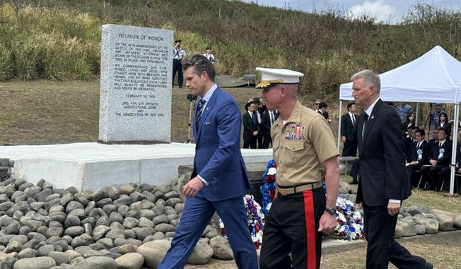
Hegseth joins veterans, generals to mark 80th anniversary of battle of Iwo Jima
A handful of retired Marines – all in the late 90s or over 100 — joined Defense Secretary Pete Hegseth and Japan’s Prime Minister Takeru Ishida on Saturday to mark the anniversary of one of the bloodiest battles of World War II in the Pacific that ended 80 years ago this week.